May initialization · ECMWF SEAS5 calibrated with CHIRPS · JJAS R1+R2 rainfall domain
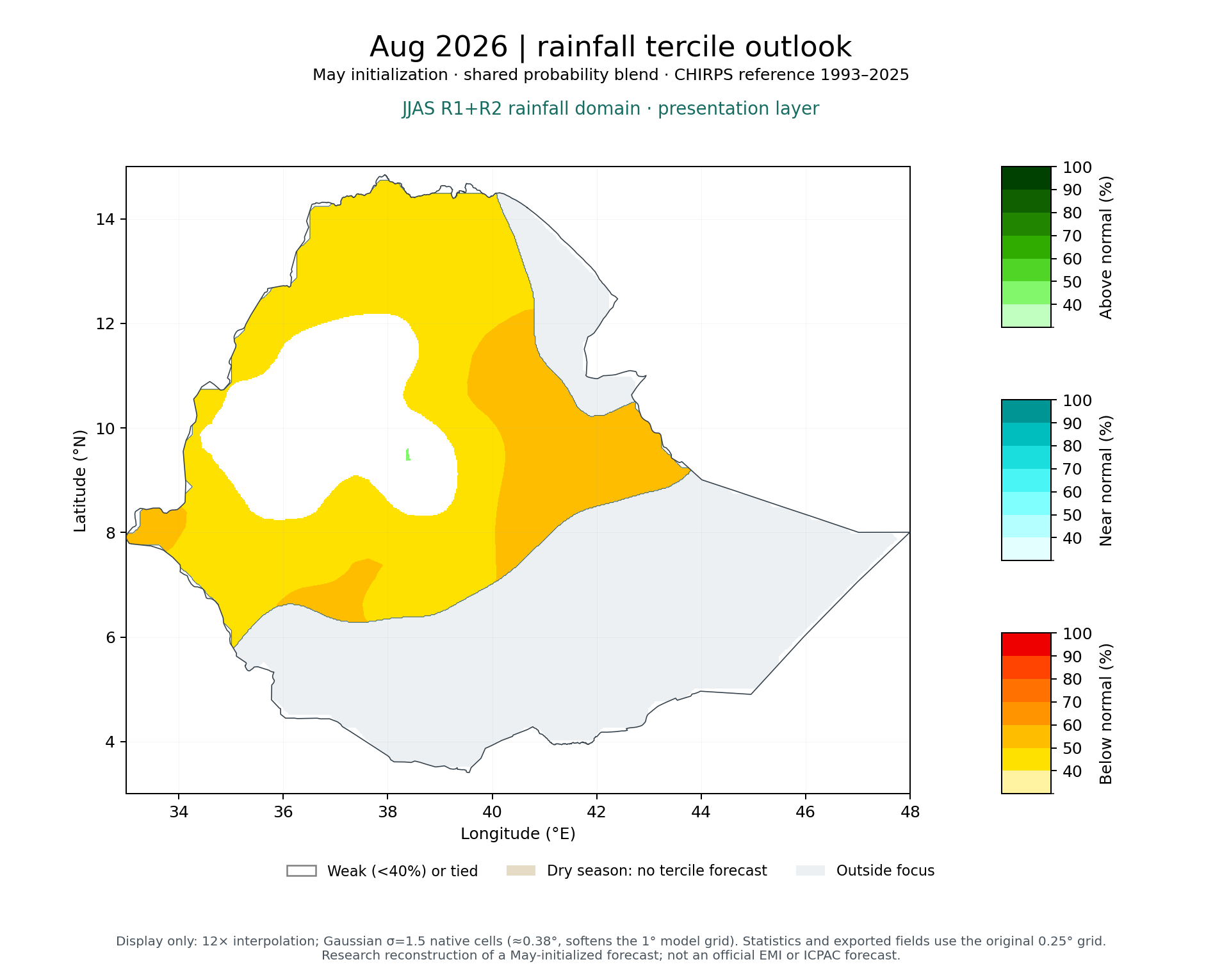
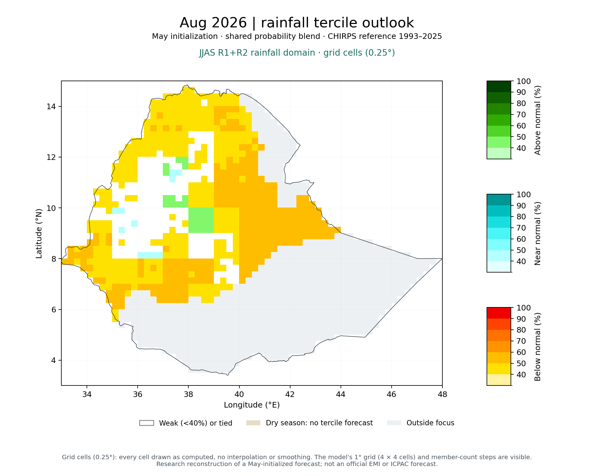
Aug 2026 rainfall outlook
Research reconstruction · not an official EMI or ICPAC forecastVerification published
The forecast leans toward below normal rainfall in the JJAS R1+R2 rainfall domain: averaged over the area, the local probability of below normal is 45%, against about 33% for climatology. Mean forecast rainfall is 226 mm against a 1993–2025 average of 261 mm (−34 mm, −13%).
Average local probability
Each grid cell has its own tercile probabilities; these are their averages over the 100% of the area that has probabilities. They are not the probability that the area-total rainfall falls in a category.
Rainfall amount
Amounts cover 100% of the area. They come from the amount-corrected ensemble, calibrated separately from the probabilities, so the two can differ slightly.
Forecast signal
Moderate tilt toward below normal
Largest area-average probability 45%, compared with a one-third reference. The local climatological probabilities (observed tercile frequencies in the training years) are close to, but not exactly, one-third. Based on probabilities only.
Historical skill — JJAS R1+R2 rainfall domain
Small estimated improvement; skill uncertain
Probability skill (RPSS) +0.011 for Aug, cross-validated 1993–2016 (95% interval −0.006 to +0.027); better than climatology in 16 of 24 years. One-target p = 0.103; adjusted for testing 5 targets (Holm), p = 0.308 (not significant after adjustment). Details
Signal strength describes how far this forecast's probabilities depart from climatology. Historical skill describes how forecasts made the same way scored in past years. A strong signal is not a confidence rating.
All targets in this cycle
-
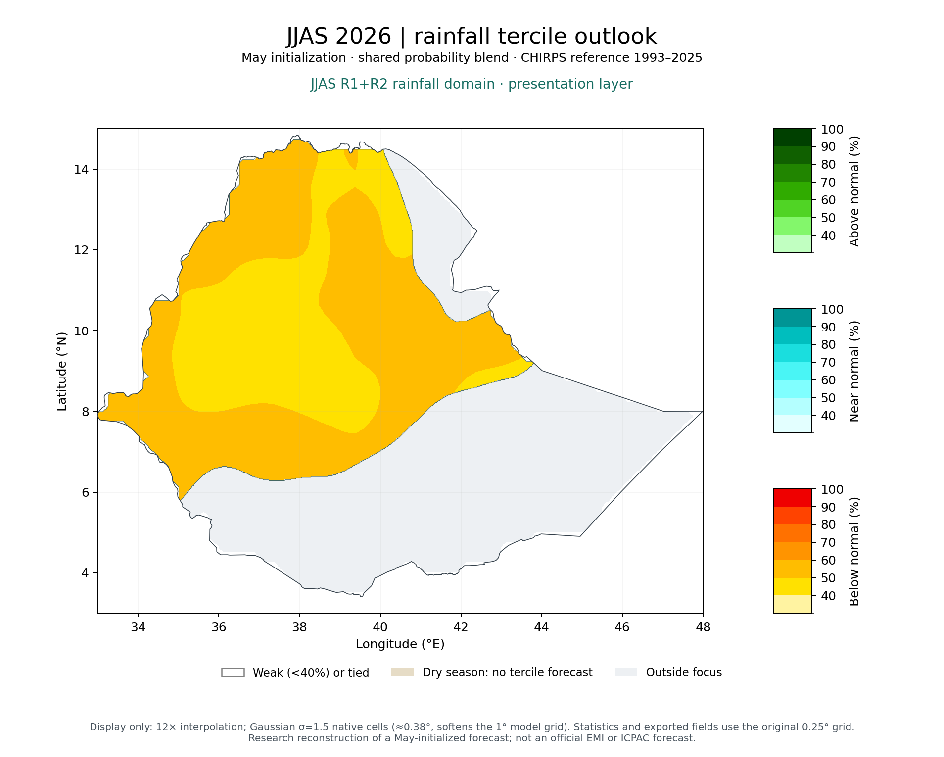 JJAS 2026
B 51% · N 27% · A 22%
Verification published
-
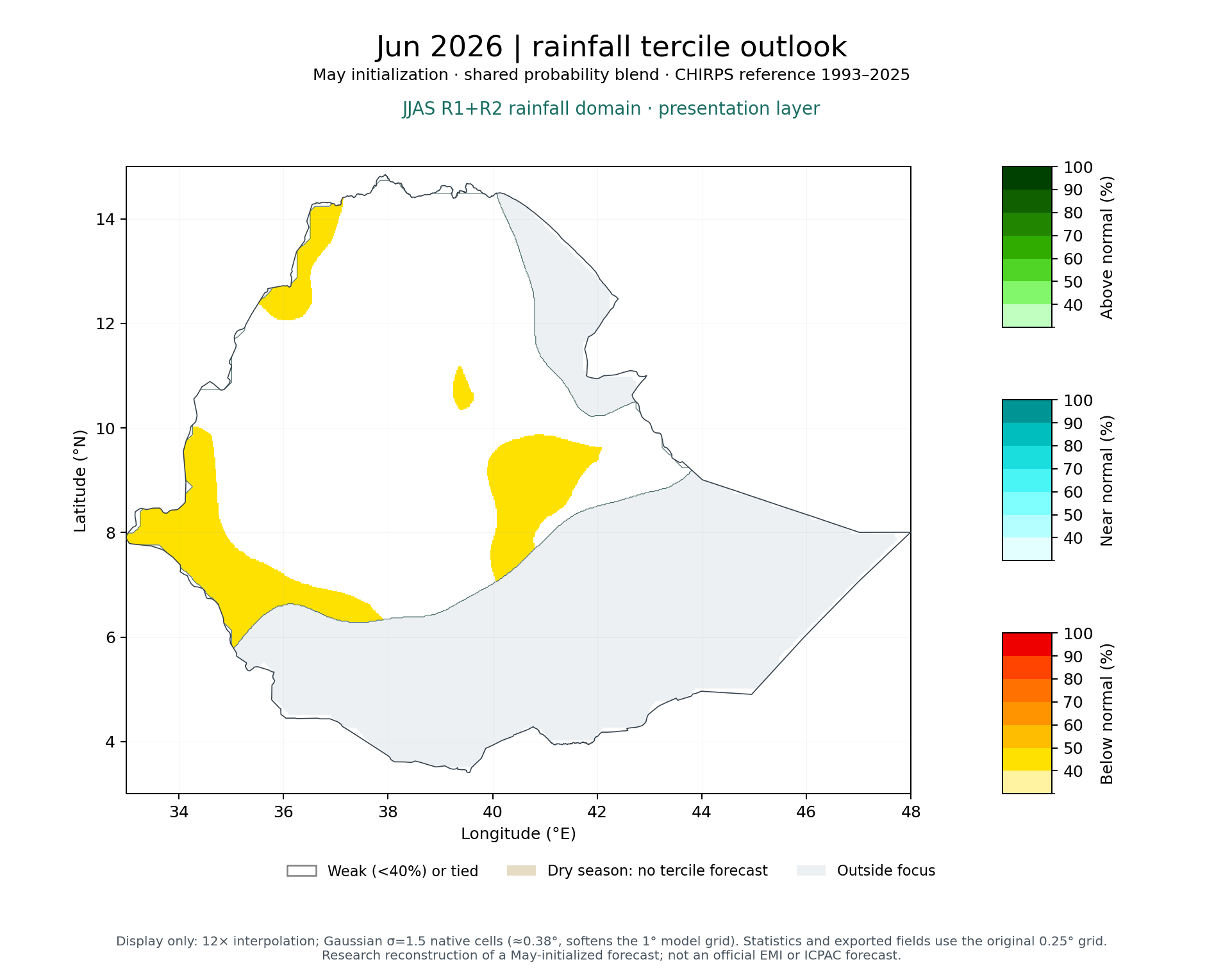 Jun 2026
B 39% · N 32% · A 29%
Verification published
-
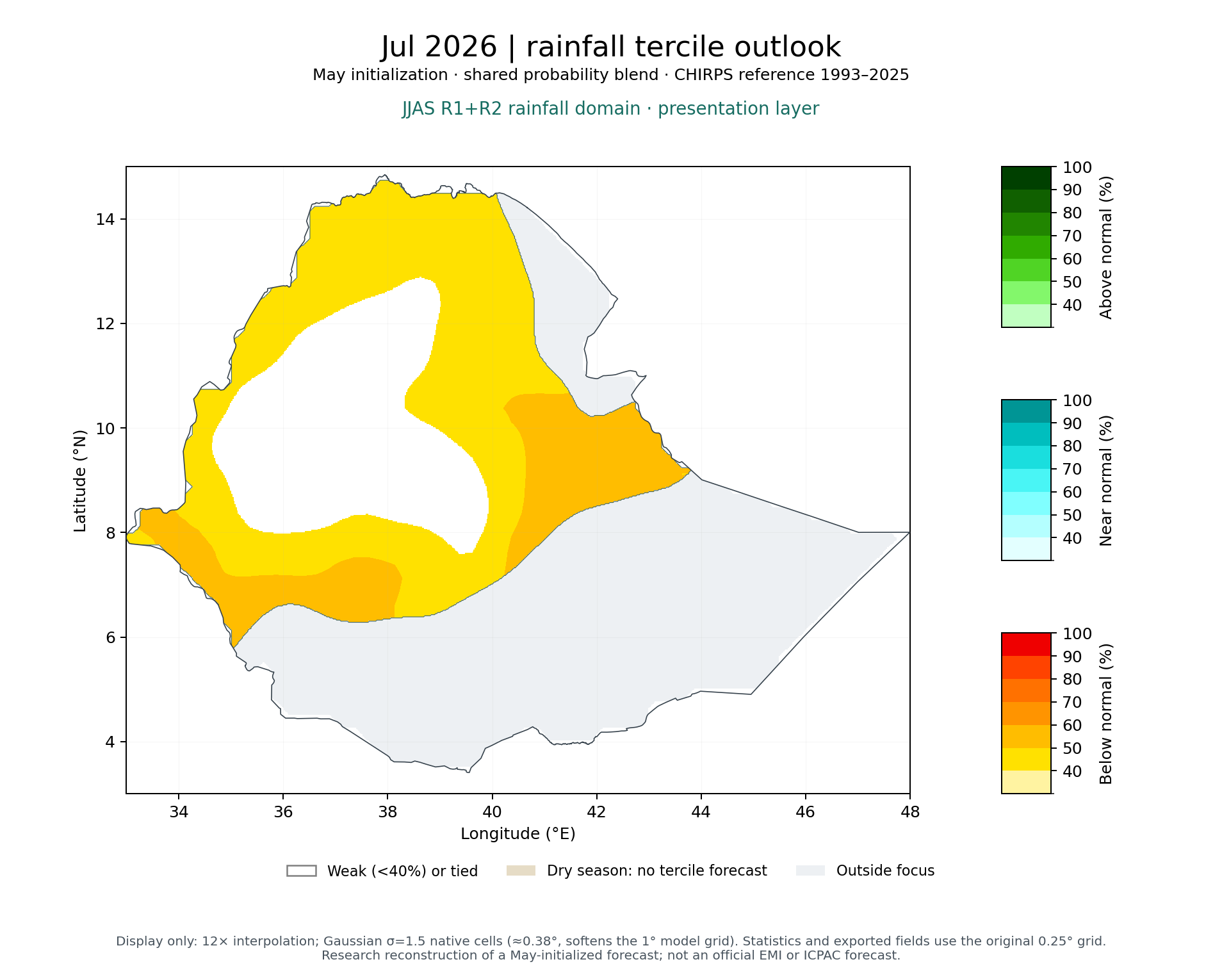 Jul 2026
B 43% · N 30% · A 27%
Verification published
-
Aug 2026
B 45% · N 29% · A 27%
Verification published
-
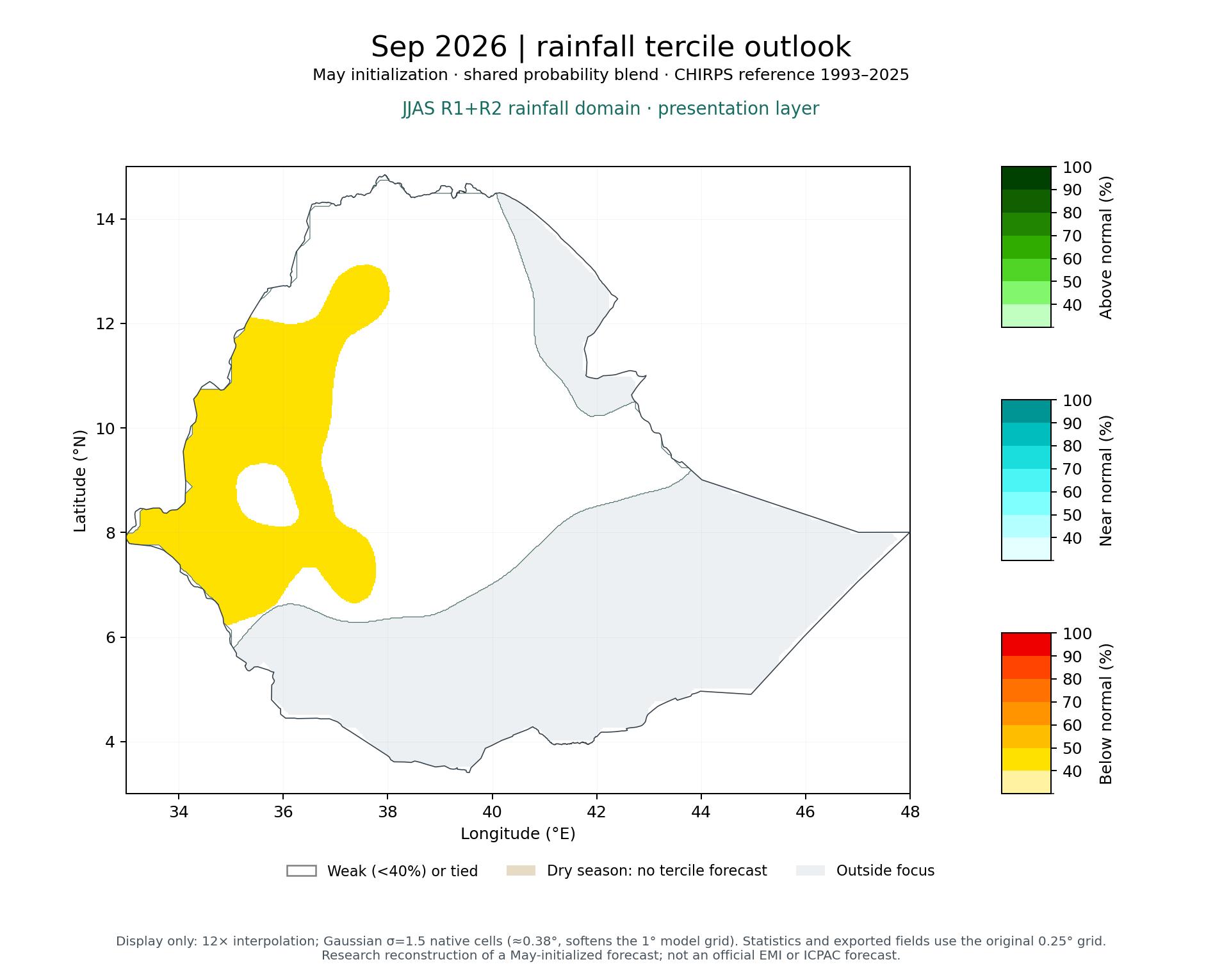 Sep 2026
B 39% · N 31% · A 30%
Verification published
The targets as a table
| Target | Period | Below / near / above | Probability coverage | Anomaly | Verification status |
|---|---|---|---|---|---|
| JJAS 2026 | 1 Jun 2026 – 30 Sep 2026 | 51% / 27% / 22% | 100% of area | −131 mm | Verification published |
| Jun 2026 | 1 Jun 2026 – 30 Jun 2026 | 39% / 32% / 29% | 100% of area | −32 mm | Verification published |
| Jul 2026 | 1 Jul 2026 – 31 Jul 2026 | 43% / 30% / 27% | 100% of area | −32 mm | Verification published |
| Aug 2026 | 1 Aug 2026 – 31 Aug 2026 | 45% / 29% / 27% | 100% of area | −34 mm | Verification published |
| Sep 2026 | 1 Sep 2026 – 30 Sep 2026 | 39% / 31% / 30% | 100% of area | −31 mm | Verification published |
Probability coverage is the share of the area with tercile probabilities; averages are over that share only. Cells with very little reference-period rainfall have no terciles.
Maps
How to read this map
Grey, white and blank areas; smoothing and resolution
Light grey: outside the selected area. Dark grey: inside the area but without values, for example cells where reference-period rainfall is too small for tercile categories, or (percent maps) below 10 mm. White on tercile maps: no category reaches 40%, or two categories tie. Sea cells have no CHIRPS data.
Smoothing and resolution. Maps are drawn on a 12× finer display grid with light Gaussian smoothing (σ = 0.6 grid cells); all numbers on this page use the original 0.25° grid. The model's own resolution is about 1°: each model cell covers 4×4 grid cells, so detail within a 1° box comes from local CHIRPS rainfall statistics used in the amount correction, not from the model.