High-Resolution Digital Elevation Model Data for WRF-Hydro Model
![]()
Source of High-resolution Digital Elevation Models (DEM)
High-resolution Digital Elevation Models (DEMS) can be obtained from the Earth Engine Data Catalog.The Earth Engine Data Catalog can be found at the following URL https://developers.google.com/earth-engine/datasets/catalog
Datasets
1) NASA SRTM Digital Elevation 30m (SRTM V3):
- Provider: NASA/USGS/JPL-Caltech: Shuttle Radar Topography Mission
- Resolution: approximately 30 meters (1 arcsec )
- Source: https://developers.google.com/earth-engine/datasets/catalog/USGS_SRTMGL1_003
2) ALOS DSM Global 30m v3.2 dataset:
- Provider: JAXA Earth Observation Research Center
- Resolution: approximately 30 meters (1 arcsec )
- Source: https://developers.google.com/earth-engine/datasets/catalog/JAXA_ALOS_AW3D30_V3_2
3) NASADEM: NASA NASADEM Digital Elevation 30m
- Provider: NASA / USGS / JPL-Caltech
- Resolution: approximately 30 meters (1 arcsec )
- Source: https://developers.google.com/earth-engine/datasets/catalog/NASA_NASADEM_HGT_001
4) Copernicus Global Digital Elevation Models
- Provider: European Space Agency, Copernicus Programme
- Resolution: approximately 30 meters (1 arcsec )
- Source: https://portal.opentopography.org/datasetMetadata?otCollectionID=OT.032021.4326.1
Tool for downloading high-resolution DEM
OpenTopography DEM Downloader
The OpenTopography QGIS-plugin facilitates access to high-resolution DEM from OpenTopography.org. The available global high-resolution topographic DEMs include:
- SRTM 30m
- ALOS World 3D 30m
- SRTM GL1 Ellipsoidal 30m
- Copernicus Global DSM 30m
- NASADEM Global DEM
The plugin’s detailed information can be found at https://opentopography.org/ or https://github.com/OpenTopography
Install OpenTopography plugin
Step-1: Open QGIS and go to Plugins menu then Manage and Install Plugins…
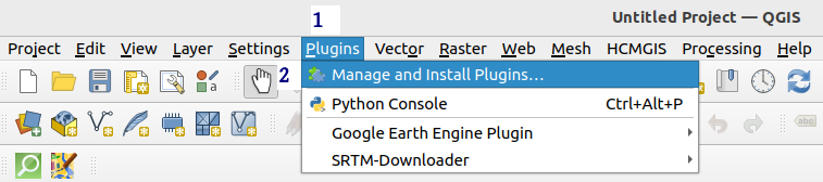
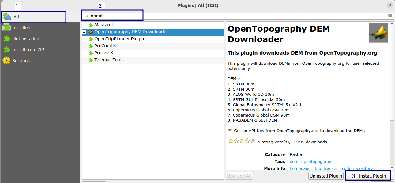
Step-2: Click on All, in the search bar type opentopography plugin, and when the OpenTopography DEM Downloader appears click on the Install Plugin
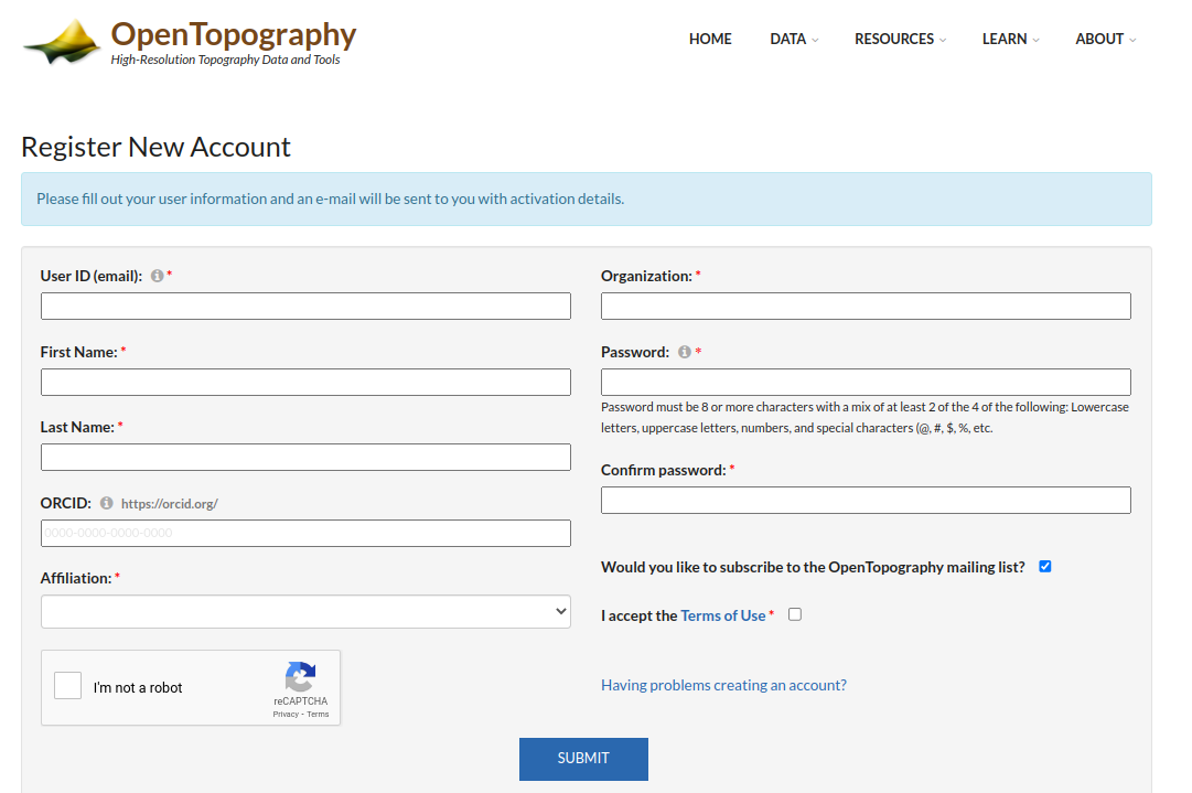
Step-3: Once the installation is complete, open the following URL: https://portal.opentopography.org/newUser and create account on OpenTopography site. You need to conform your registration via your email.
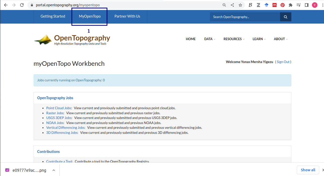
Step-4: Get an API Key from OpenTopography.org. Login to your new OpenTopography account via https://portal.opentopography.org and click on the myopentopo tab.
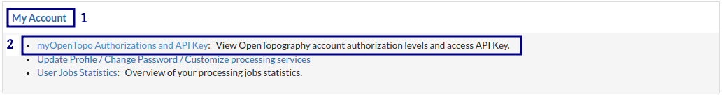
Go the bottom of the page on My Account and click the following link myOpenTops Authorizations and API Key https://portal.opentopography.org/lidarAuthorizationInfo to create API Key.
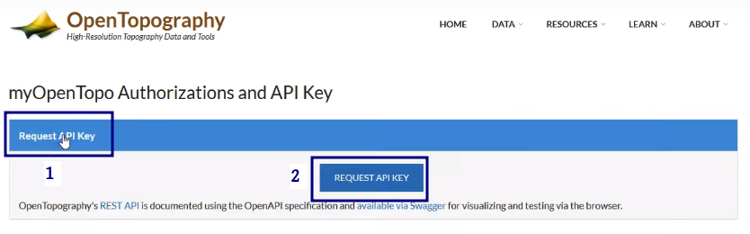
Click on request API KEY
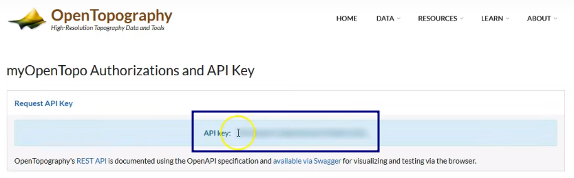
This will give you the API KEY for downloading DEM data from OpenTopography repository. Copy the KEY and save it somewhere for later use.
Downloading High resolution DEM
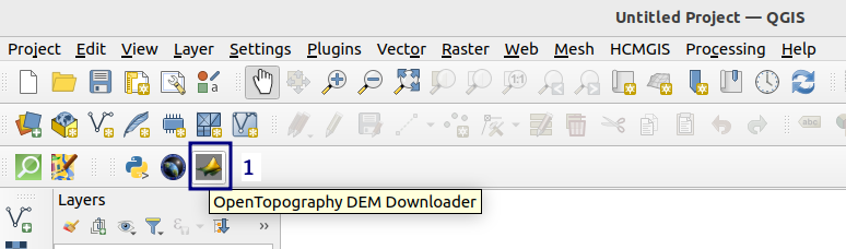
Let’s use QGIS and OpenTopography to download high resolution DEM. Click on the OpenTopography DEM Downloader button as shown in the following figure.
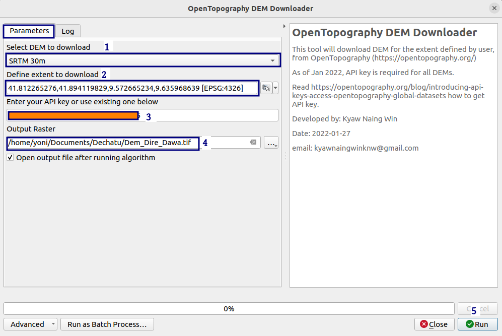
This will bring up the OpenTopography DEM Downloader dialog box. In the Parameters tab fill the following information:
Select DEM to Download: Select either
SRTM 30,ALOS World 3D 30m,SRTM GL1 Ellipsoidal 30m,Copernicus Global DSM 30m, orNASADEM Global DEMDefine Extent to Download: Here you have multiple options to define the extent of the study area. This includes:
Calculate from Layer,Use Current Map Canvas Extent, andDraw on Map CanvasEnter your API Key or use the existing one bellow Paste the API Key you get from previous step.
Output Raster: Give output name for the DEM and finally Click the
Runbutton.
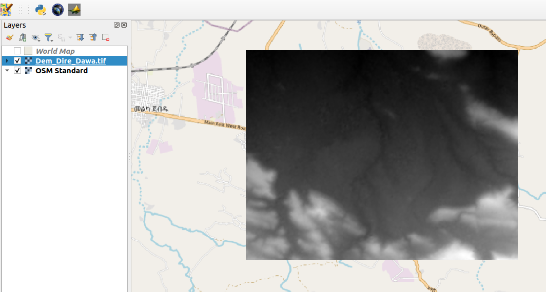
When the data download is complete, the QGIS Layer will be automatically loaded, as shown below. Here we downloaded a 30 meter SRTM high resolution DEM for Dire Dawa city and its surrounding areas.
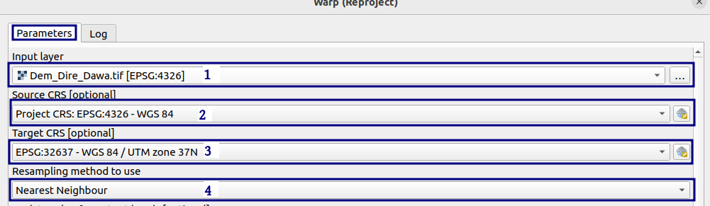
Finally, we should re-project the DEM in order to use it in the WRF-Hydro model for hydrological applications. Go to Raster then Projection, and Warp (Projection...) . This will open the projection dialog box:
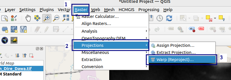
In the Input Layer select the DEM data you downloaded. In this case the
Dem_Dire_Dawa.tifSource CRS: select
EPSG:4326Target CRS: select
EPSG:32637 - WGS/UTM zone 37NRe-sampling Method to Use:
Nearest NeighbourReProjected: Output name:
projected_dire_dem.tifand finally clickRun
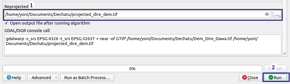
This will load the re-pojected DEM data in the QGIS Layer Panel.
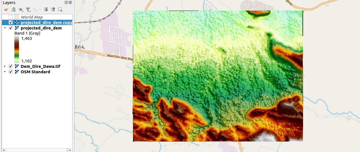
This DEM can be used as input for building hydrological routing grids in the WRF-Hydro GIS pre-processing tool.
🥇**Happy WRF-Hydro Modelling.** 🥇
Leave a Comment